Street View of Highway 2 in the UP
After mapping out only the first few days I realized that
the Upper Peninsula of Michigan was pretty sparse. Not only are there very few roads up there
but there are also very few towns. This
created a problem because I had to have a hotel and a restaurant every
night. To find suitable accommodations
over the first four days the route turned out to be one 95 mile day then three back
to back 120 mile days. I was concerned
this would be too much but I really didn’t have much choice. After I got out of the Upper Peninsula I
could go back to a more regular 100 mile a day route. With some slight modifications I soon had a
turn by turn map of each day that could be easily stored and modified along the
way. The next question was how to take
each day’s route with me.
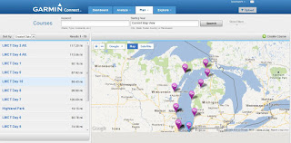
Map of all my final courses plotted in Garmin Connect (I had alternate routs for some days)
I decided to try out the map function on my Garmin 705 bike
computer. The computer has a built in
GPS mapping system but I had never used it on such a scale before. I started by testing a map that I had created
online on the Garmin website. I
downloaded the map to my bike computer and the route showed up as a pink line
that I could follow. I did a few test runs
over the next few days on my way to work and decided that it would work very
well for guiding me to where I needed to go.
I was still nervous using something that was still relatively new to me but
I felt confident that it would work. I transferred
all my routes onto the Garmin website and then downloaded them to my GPS
Device. By the time I was done I had 10
portable Garmin Files that I could bring up on my bike computer each day and follow
from door to door. Technology is a
beautiful thing!


No comments:
Post a Comment